Lake Monticello History
History Gives Life to Present:
Everyone who has ever lived at Lake Monticello has a story of how they got here. Most came in search of some common goals - quiet, rural living; escape from the hustle and bustle of big cities; a slower, more relaxed pace of life. Some came because they visited family or friends and loved it here; some came because of the excellent value in close proximity to Charlottesville. The recreation possibilities were a big draw for some, and others came simply because it's a good, safe place to retire or to raise a family.

The knowledge of where and how we began is helpful when determining where we are now and where we're headed. When we began uncovering the story of Lake Monticello's beginnings, we found a multi-layered history. While there is much more to learn, here are just a few snippets of the rich history that exists here.
Although there is more than one account of how Lake Monticello came to be, one describes how Lake Monticello was first conceived by a group of local businessmen in 1958. A business plan dated June 1, 1962 noted that a site for a recreational community had been found 13 miles from Charlottesville, bounded by Routes 53, 600 and 618, with the possibility for impoundment of 420-450 acres of water. The lake would have 16 miles of shoreline and be 2.5 miles long. The elevation of the shoreline would be 320 to 400 feet above sea level, "affording a magnificent view of the Blue Ridge Mountains as well as the lake." The lake was to have been named Boston Lake for the creek that would feed it. The four men who put together this plan - Robert Harmon, Harry Lewis, Aubrey Huffman and David Turner - formed a fictitious corporation, Nahor Milling Corporation, to acquire land.
According to an article written in 1995 for the Lake Monticello Review by Judge Ralph Zehler, legal counsel for the investors, the corporation was fictitious in the sense that it was not at Nahor and had nothing to do with milling. The article describes the individual properties obtained for the community: a parcel of 210 acres on Adrien's Creek, extending from Rt. 53 to the pipeline, was owned by Virginia State Senator Ed McCue and was the first to be purchased for just $100 per acre in 1962. It is on this tract that the fishing lake is now located. A tract of 159.5 acres on Boston Creek was owned by Oakley Skeen and includes the area of Old Homestead Circle, named for the frame house that originally sat on the property. According to the article, Harry Faulconer, who eventually completed the development of Lake Monticello, built his own home on that site. Two additional parcels, totaling 320 acres, were owned by Charlotte and Walter Neuhauser, who moved here from New England in 1952. Until just a few years ago, portions of the farm buildings still stood on the site that now includes The Acres development. A tract of 175 acres, owned by the Garrison family adjoined the Skeen and Neuhauser properties. The largest tract of land obtained was owned by the Purcell family under the name of Louisa Land and Lumber Corporation. Called the Boston Tract, it contained 1200 acres and extended from Rt. 618 to the present location of the Fire & Rescue Building and comprises most of the current Section 1, including the area of the dam, and much more. Additional land purchased from Garland and Ruby Carter is in the center of the lake bottom.
With the unexpected death of Bob Harmon in 1967, plans for the community changed dramatically, and the land that had been acquired by that time was sold to Great Eastern Development Corporation, a different group of men who had dreams of their own but with similar characteristics. Great Eastern began the actual development of the accumulated properties, laying out the lots, contouring the lake, building the dam, and designing the golf course. One of the partners was Harry Faulconer, whose construction firm bought out the other partners and eventually completed the development.
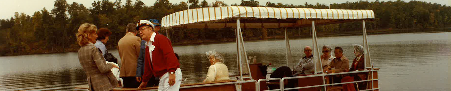
In 2009, we met Joseph Conte, one of the partners of Great Eastern Management. Mr. Conte dreamed of a community such as Lake Monticello and, as president of the Great Eastern Management Co., oversaw much of the major construction. In coming months, plans are to include in this space an account of this period from his point of view.
There are many interesting facts and tall tales about the community and about the land Lake Monticello occupies. For instance, it is true that the lake received a huge quantity of water from the rainfall during Hurricane Camille in 1969 and the contents of another nearby lake when its dam gave way during the storm. But Camille did not fill the lake overnight. The lake already had 35 or 40 feet of water at the time Camille came through. [Camille was the same hurricane that took a heavy toll of lives and property in Nelson County to our west.]
No, it is not true that heavy equipment was abandoned at the bottom of the lake. According to reliable sources, there was a bulldozer that was flooded on the dam, but it was rescued, repaired and put back into operation. Apparently, there was fear that the freshly packed earth of the new dam might not hold in the onslaught of quickly rising water during the powerful hurricane. The bulldozer was used to cut a gap in the dam to reduce the pressure. The cut-away area of land on Route 618 near where it intersects with Route 600 was left when soil from that site was used to repair the breach in the dam later on.
Yes, Lake Monticello is located on a geological fault - an earthquake measuring 3.8 on the Richter scale was documented on August 18, 1984. The epicenter apparently was beneath the lake itself. Property owner and former Director Jean Burns said it sounded like an explosion, and the water in the lake appeared to be flowing from two directions at once.
More recently in the Fall of 2011, Lake Monticello felt the effects of a stronger earthquake -- 5.8 on the Richter scale -- with the epicenter in the area of Mineral in adjoining Louisa County. Although there are many tales of experiences during the earthquake, there was no significant damage or injuries reported at the Lake.
No, there are no reliable records of an abandoned village at the bottom of the lake, although the town of Barnardsburg was located nearby, just downstream from the dam near where Boston Creek meets the Rivanna River and near the location of two canal locks that are on Lake Monticello property.
- First home built here belonged to Charlotte and Walter Neuhauser and family on Pineknoll, just a few blocks from the Clubhouse.
- First child born here was Kip Gansneder, a daughter born in 1972 to Nancy and Bruce Gansneder.
- Wes Volk was the first property owner who served as President of the Board of Directors. He served as a Director for four years beginning in 1973.
- First woman on the Board of Directors was Nancy Gansneder in 1974.
- Joan Volk, who was on the first Environmental Control Committee, also named the rooms in the Clubhouse and designed the original logo in the early 1980s.
- First dog was Inky, a black Labrador Retriever owned by the Neuhausers.
- The flagpole at Marina is dedicated to first Marina Manager, Ken Luxhoj.
Below the story of how Lake Monticello began is a significant layer of history far distant from our own. The town of Barnardsburg, located on the west side of the Rivanna River where Boston Creek empties into the River, was chartered by the Virginia General Assembly in 1796. Tradition says that General Lafayette's men spent the night in Barnardsburg on their march to Yorktown where Cornwallis's surrender ended the Revolutionary War more than 200 years ago in 1781. The two stone chimneys that still stand across Jefferson Drive from the Marina are the last evidence of a house called "Red Hills," which was built before the Revolutionary War by the Barnard family. It eventually came into the hands of the Boston family, members of which are buried in the nearby cemetery along with members of the Cocke family, who were related by marriage. One of the Boston sons, Col. Reuben B. Boston, who was thought to have been the last Confederate officer killed in the American Civil War in 1865 at age 31, is buried in the cemetery.
Southeast of the house on a point overlooking the village of Barnardsburg, was a fort, also built before the Revolution. There also was a mill in the town, which was run by the Boston family from around 1806. The town died out in the late 1800s as navigation on the Rivanna River and Canal slowed and the railroads took over. Most of the remains of the town eventually disappeared from decay, floods and scavenging and later on from construction of the Lake Monticello dam. Two well-preserved canal locks still exist and have been uncovered during years of work by some dedicated Lake Monticello and Fluvanna County residents. There still is evidence of the mill and a few other buildings between State Route 600 and the Rivanna River, but many of the stones from the old buildings eventually were used for other construction.
On Sunday, October 27, 2002, the Fluvanna County Historical Society dedicated a plaque commemorating the town of Barnardsburg and the Bernard and Boston families for the role they played in Fluvanna's social and economic history. The plaque is located on Jefferson Drive, across from the Marina near the ruins of "Red Hills."
In 2000, LMOA embarked on an effort to research and record the history of Lake Monticello. With the commencement of that project, it became clear that Lake Monticello's history will not be complete without the history of Fluvanna County, Virginia. Much information is available through the Fluvanna County Historical Society and from individuals whose research has been extremely valuable. One of the major segments of documenting our history is in obtaining photographs and oral histories, a process that is slow and ongoing.
For more information, to donate photographs or documents, or to offer your help, please call Member Services at 434-589-8263.
